TURKMENISTAN
TURKMENISTAN

Turkmenistan is a country in Central Asia. It is the second largest state in Central Asia, after Kazakhstan, and the southernmost of the region's five republics. The country is bordered by Kazakhstan on the northwest, Uzbekistan on the north and east, Afghanistan on the southeast, Iran on the south, and the Caspian Sea on the west. After Kazakhstan, Turkmenistan is the least densely populated of the Central Asian states. Much of its waterless expanse is inhospitable to plant and animal life. Except for oases in narrow strips dotted along the foothills of the Kopet-Dag Range and along the Amu Darya, Morghab, and Tejen rivers, deserts characterize its sun-baked, sandy terrain. From 1925 to 1991 Turkmenistan was the Turkmen Soviet Socialist Republic, a constituent (union) republic of the Soviet Union; it declared independence on Sep. 27,1991. The capital is Ashgabat (Ashkhabad), which lies near the southern border with Iran.
THE GUEST HIGHER THAN THE FATHER
Turkmenistan is the home of some of the World's oldest civilizations, having made a significant contribution to the development of World culture. Modern Turkmenistan's borders first appeared in the world around the same time as India and the Middle East. Historical sources prove that in the 3rd-2nd millennia BC two large states, which were consolidated nations living far from each other in the desert and river valleys, were established on the territory of present-day Turkmenistan.
Climate
Turkmenistan has an arid desert climate with extreme summer heat and sub-freezing winter temperatures. Turkmenistan enjoys a dry, continental climate, with very hot summers (rarely below 35°C and occasionally up to 50°C in the southeastern regions of the Karakum Desert). Turkmenistan enjoys an average of 250 sunny days annually. In the south of Turkmenistan the climate is also slightly more continental than in the north and temperatures seldom drop below 5°C. Northern areas, near the Uzbek border and Khorezm (Dashoguz), can become very cold in winter with temperatures dropping below -20°C. The best months for moderate temperatures are April and May for the beautiful blossoming deserts and mountains. September and October are great for an abundance of fresh fruit and vegetables, in the autumn harvest season.
Nature
According to natural conditions, Turkmenistan is located across three main natural landscape zones: deserts, oases and mountains. 13 different natural areas may be distinguished in the country: plains 15%, mountains and foothills 12%; water and non-soil formations (talus, rocks, and precipices) occupy the majority of the country's surface - 73%. The Karakum desert occupies the northern and central part of the country (about 80% of its territory).
The highest point in Turkmenistan is Ayrybaba Peak of the Koytendag Mountain Range (3,139 m); the lowest point is the Akchakaya depression in the northwest of the Zaunguz Karakum (-81 m). The length of Turkmenistan's coastline on the Caspian Sea is 1,200 km.
ASHGABAT
Ashgabat is the capital and largest city of Turkmenistan. This cultural, scientific, and economic hub has seen rapid growth in recent decades, adding numerous monuments and white marble buildings, earning it the nickname "White City".Ashgabat is a relatively young city in 25.05.2013 city was included Gunnies Book of records as a white marbled city on the world.
Ashgabat Sights & Attractions
Ashgabat is known for its modern monuments that symbolize the new independent Turkmenistan. Among the most famous sights are Independence Park, the Monument of Neutrality, the 133-meter high Flag of Turkmenistan, the "Bagt Koshgi" marriage palace, and the cultural and entertainment center "Alem".
The city also boasts several beautiful mosques. In the city center, you'll find the Ertogrulgazy Mosque (also known as Azadi), which resembles Istanbul's famous Blue Mosque. Just 11 km outside the city is the colossal Turkmenbashi Ruhy Mosque, known for its size and rich decoration.
Some of Ashgabat's most famous historical monuments are located nearby: the ancient city of Nisa, 15 km to the west, and the city of Anau with the Seyit Jamal ad-Din Mosque, 11 km to the east. A couple of notable Soviet-era sights in Ashgabat include the Lenin Monument on an unusual pedestal and the Russian Bazaar with its unique architectural design.
Museums of Ashgabat
Ashgabat features two very interesting museums: the State Museum of Turkmenistan and the Carpet Museum. The State Museum has a rich collection of artifacts from the country's history, from antiquity to the present day, including art objects, historical documents, carpet samples, and other items. The total number of exhibits exceeds 130,000.
The Turkmen Carpet Museum is unique, showcasing 2,000 handmade carpets. The largest of these carpets, which covers an area of 301 square meters, is listed in the Guinness Book of Records. Carpets are a significant symbol in Turkmenistan, and the country even has a dedicated holiday to celebrate them, which is brightly commemorated at the museum.
In addition to these popular museums, visitors to Ashgabat can also explore the Museum of Wildlife, the Museum of Fine Arts, and the "Ak Bugday" Museum, which is dedicated to wheat and its cultivation in Turkmenistan.
INDEPENDENCE PARK
In the southern part of Ashgabat, you'll find the city's main park – the National Independence Park. It's a major attraction of the capital, home to several symbols of modern independent Turkmenistan, including the impressive Independence Monument, the monument to the book "Ruhnama", and bronze sculptures of many great historical figures.
The park spans an area of 140 hectares, with dimensions of 800x1750 meters. It's covered in lush greenery, making up half of Ashgabat's total greenery.
MONUMENT OF NEUTRALITY
The Monument of Neutrality is one of the most famous landmarks in Ashgabat and a key symbol of modern Turkmenistan. Standing at a towering 95 meters, the monument is supported by three massive pillars and topped with a 12-meter golden statue of the first president, Saparmurat Niyazov. Its impressive structure is hard to miss and leaves a lasting impression.
ERTOGRULGAZY MOSQUE
Ertogrulgazy Mosque, sometimes called Azadi Mosque due to its location on Azadi Street in central Ashgabat, is one of the most beautiful mosques in Turkmenistan. Its design is Turkish, inspired by Byzantine architecture, making it resemble the Blue Mosque in Istanbul.
The idea to build this mosque came from Turkish Prime Minister Suleyman Demirel, who visited Turkmenistan in 1992. By early 1993, construction had begun, and the completed mosque was unveiled to worshippers in 1998. It was named after Ertogrul, the father of Osman I, the founder of the Ottoman Empire.
TURKMENBASHY RUHY MOSQUE
Turkmenbashy Ruhy Mosque in Kipchak: the largest mosque in Central Asia - The prayer room can simultaneously hold 10,000 pilgrims – 7,000 men and 3,000 women (the women have a room exclusively for their use on the second level). All conditions are brought together for believers. A powerful ventilation system controls the temperature in the prayer room and, in the winter, a heated floor system is used. The prayer room is covered by an immense 215 m2 carpet reproducing the eight-branched star of Oghuz-Khan.
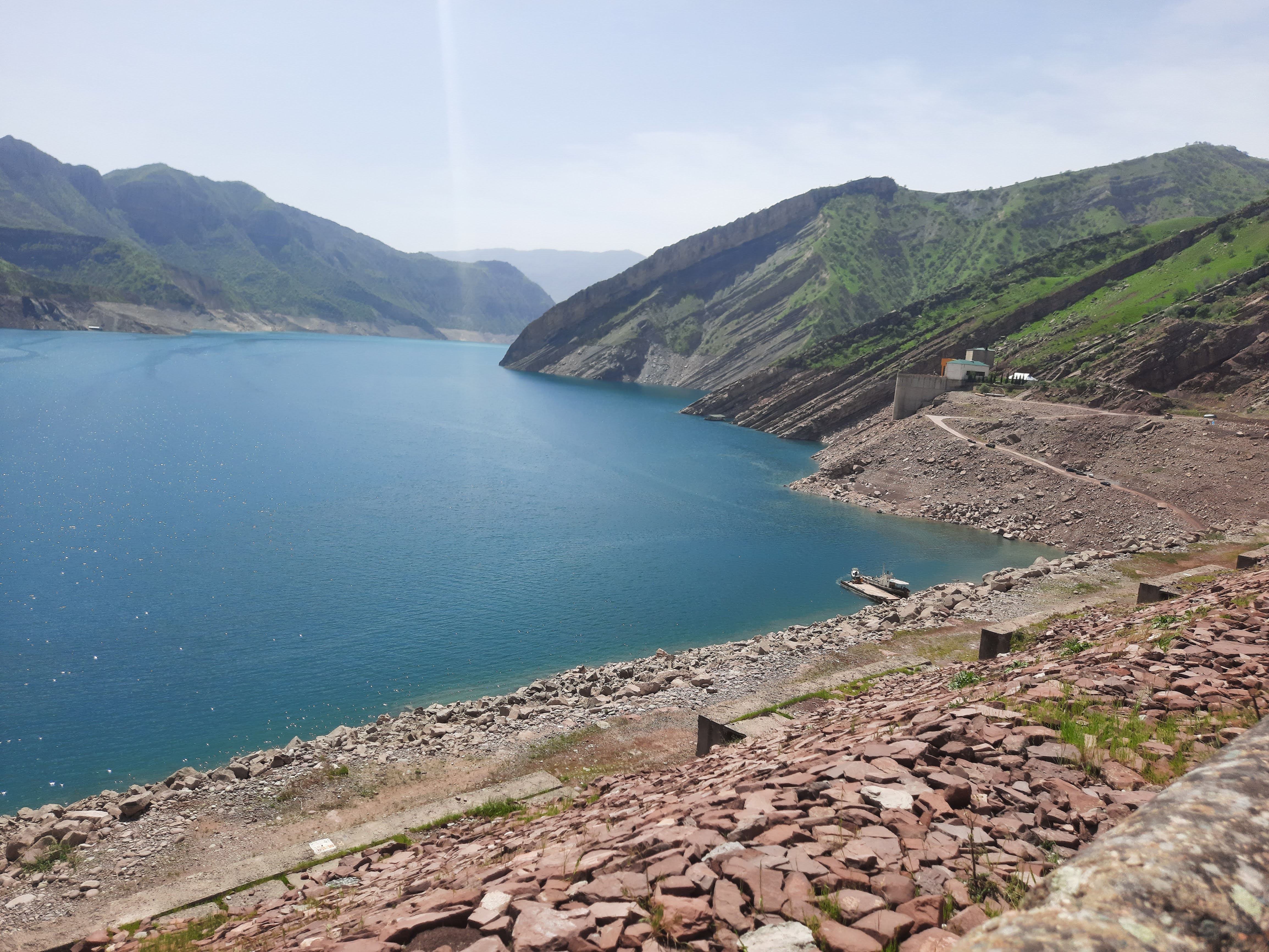
KOV ATA UNDERGROUND LAKE
Kow-Ata Underground Lake is located in Baharly (formerly Bakharden) in the foothills of the Kopet-Dag Mountains (107 km west of Ashgabat). The Turkmen name Kow-Ata means "father of caves". At first glance, this underground area appears like a magnificent auditorium: the overall length of the cave is 230 m, its height reaches 20 m, and its width is at some points 57 m. The bottom of the cave is covered with lumps of dissolved limestone (stalagmites), and its warm and gushing water is clear and emerald colored. Even under artificial lightning, tiny pebbles on the bottom can be seen. As you approach the lake, you will feel the air becoming damper and warmer. You can hear sounds like sighs or whispers above your head. These are the pigeons which inhabit the cave in great abundance. The water has a constant temperature of 33-37°C. Chemical analysis has shown that the water contains a complex combination of chemical elements - over 30 of which have been found to date.
GOKDEPE
Gokdepe (formerly Geok-Tepe) is a small town located 45 kilometers northwest of Ashgabat. At first glance, it might seem like an ordinary provincial place, but in 1881, an event here shaped the future history of Turkmenistan. Today, about 22,000 people live here, primarily engaged in agriculture. The main attractions in Gokdepe are the Saparmurat Hajji Mosque and the ruins of the Geok-Tepe fortress.The Geok-Tepe fortress was completed rapidly. It measured 1450x670 meters, covering an area of 1 square kilometer. The fortress walls stretched over 4 km, with a height of 6-7 meters and a thickness at the base of 8 meters. In 1879, the Russian army under General Lazarev first attempted to capture the fortress. An expedition of over 7,000 people, including 4,000 infantry, 2,000 cavalry, and artillery with 16 cannons, was organized. However, due to poor planning and underestimating the fortress defenses, the Russians were defeated and retreated.The Saparmurat Hajji Mosque, built in 1994-1995, honors the fortress's defenders and is named after Turkmenistan's first president's pilgrimage to Mecca. The mosque, which seems small from the outside, can accommodate 8,000 worshippers, with a large hall for men and a prayer hall for women on the second floor. Non-Muslims can enter by wearing special robes provided at the entrance.
The National Museum of Gokdepe has an excellent collection of items and documents related to the battle, including paintings illustrating the siege and massacre.
OLD & NEW NISA
Nisa is an ancient city located 15 km west of Ashgabat. Today, it consists of ruins and remnants of fortress walls, but 2000 years ago, it was one of the most important centers of civilization in Central Asia and even served as the capital of Parthia for some time. Nisa comprises two fortress cities, New Nisa and Old Nisa, which are 1.5 km apart and took different historical paths in 226 AD. Archaeologists have found traces of the first settlements at Nisa dating back to the 4th millennium BC, with a large settlement forming by the 1st millennium BC. Situated at the northern foot of the Kopetdag Mountains, the settlement became a fortress by the 4th century BC, protecting the northern borders of the Achaemenid Empire from nomads. When Alexander the Great passed through, Nisa became part of his empire and later the Seleucid state.
SEYITJEMALEDDIN MOSQUE
Seyit Jamal ad-Din Mosque is one of the few medieval monuments near Ashgabat. Unfortunately, a powerful earthquake in 1948 destroyed much of it, leaving only the remnants of walls, parts of the portal, and the dome scattered around. Still, thousands of tourists visit these ruins every year. Although the ruins don’t fully convey the mosque's former grandeur, early 20th-century historians and archaeologists studied the structure when it was still intact. We have a good understanding of how this masterpiece of Eastern medieval architecture looked. The mosque stood on a hill near the ancient settlement of Anau, 12 kilometers from modern Ashgabat. It comprised a mosque, two additional buildings, and the ornate tomb of Seyit Jamal ad-Din. The mosque originally had two minarets, which didn’t survive into the 19th century, though their foundations were discovered during early explorations by Europeans. Constructed of burnt brick and adorned with majolica mosaics, its vibrant entrance portal featured two yellow dragons—an unusual and unique design for Central Asian Islamic architecture.
NOHUR
High in the Kopet Dag Mountains, the village of Nohur and the neighbouring settlements occupying the terraced sides of the upland valleys are quite unlike other parts of Turkmenistan. The local Nohurli tribe retains conservative traditions protected by the remoteness of its settlements, and has a reputation for religious piety, hard work, and in-breeding. Claiming descent from the army of Alexander the Great, Nohurlis will show you a stone in the village said to bear a footprint of Alexander’s horse. The porches of Nohur houses are indeed supported by wooden columns which recall the Ionic style. But the inspiration here perhaps draws less from Hellenism than from the horns of the local sheep. Combining fascinating villages, beautiful scenery, and excellent opportunities for guided trekking, Nohur repays a visit of several days.
The graveyard at the eastern edge of Nohur village is striking, its carved wooden tombs decorated with the horns of rams. Visitors are asked not to enter the graveyard. Just beyond is the pilgrimage site of Kyz Bibi. A fat-trunked plane tree, surrounded by a small metal fence, is covered with small scraps of cloth representing wishes. From here, a flight of concrete steps leads up to a tiny cave, just a few centimetres across, in the side of the hill. The cave is surrounded by more pieces of material, some of which have been fashioned into tiny cribs, suggesting the nature of the wishes made here. The site is one of several in Turkmenistan dedicated to Kyz Bibi: the legends surrounding this female figure of great purity usually involve her being swallowed up by the mountainside to protect her from either heathen invaders or an unwanted marriage. Beyond Nohur, the villages of Garawul and Konyegummez stand in fine upland settings.
ABIVERD FORTRESS
Eight kilometres to the west of Kaka, the ruins of the town of Abiverd lie just to the south of the Ashgabat road, and are clearly visible from it.Abiverd was once an important trading town of North Khorasan. It was a key link on the Silk Route between Nisa and Merv, and also enjoyed ties with Nishapur, across the Kopet Dag Mountains to the south. Taxes collected from Abiverd at one point in the 9th century were almost double those of Serakhs. But Abiverd never seems to have recovered its status following its sacking by the Mongols in 1221. Abiverd in its heyday had a sophisticated system of water supply, produced highly regarded pottery, and minted its own coins. The present-day site offers only a hint of these past glories. The eastern part of the site is a citadel, with earth ramparts topped in a few places by surviving stretches of mud-brick walls. The whole is surrounded by a dry moat. To the west are the crumbling mud walls of houses probably abandoned in the 18th century.
NADIR-SHAH FORTRESS
Nadir-Shah Fortress – Just over 20km south of Kaka, close to the village of Khivabad, lies an 18th-century fortress, built during the rule of Nadir Shah, founder of the Afsharid Dynasty in Iran.Set in an attractive location at the foot of the Kopet Dag Mountains, the rectangular fortress walls retain a good sense of the original structure. Fluvial erosion has destroyed most of the southern wall of the fortress, but elsewhere towers and battlements survive. From gates in the north and east walls, roads run to the remains of a large walled building in the centre of the complex. A mound reaching a height of 10m in the north wall of the fortress offers an excellent vantage point across the site. The fortress is also known as Old Khivabad: it is said that Nadir Shah, held in slavery in Khiva in his youth, vowed that one day he would move Khiva to his homeland. When he became a powerful leader, he conquered Khiva. The tale runs that he took thousands of prisoners, ordering each of them to take with them soil from Khiva. With this he constructed the fortress of Khivabad near the Kopet Dag Mountains.
MEANA BABA
Meana-Baba mausoleum, usually referred to as Meana Baba, is one of the most unjustly neglected sites of Turkmenistan, as it lies an inconvenient distance from the main Ashgabat to Mary road to make for a straightforward stop.It is nonetheless well worth the detour. Abu Said was born in 967 in the town of Meikhene, which lay on the trade route between Abiverd and Serakhs. His father was a herbalist and spice trader, who was able to give his son a fine education. Abu Said was known for his asceticism, reportedly reciting verses from the Koran while suspended head-first in a well. After spells in various cities, including Merv, Serakhs and Nishapur, Abu Said was to return to Meikhene, where he died in 1049. By the time of his death, he had become a widely respected Sufi authority, who played an important role in the political and spiritual life of the region. The Seljuk leaders Chagry Beg and Togrul Beg reportedly sought his blessing for their bid to overturn the Ghaznavids. Some criticized the use of elements of poetry, music and dance in his teachings, but he was a highly popular figure, such that it is said that a piece of watermelon, accidentally dropped by him, changed hands for the sum of 20 gold dinars. It is thus no surprise that a great mausoleum should have been built at the place of his death.
The mausoleum dates from the 11th century. It has a square base, with sides a little more than 10m in length, above which is a double dome, a feature typical of the buildings constructed in this period by the craftsmen of Serakhs. The transition between walls and dome is marked with four squinches, separated by four niches, each containing a small window. The entrance to the mausoleum is framed by a tall, arched portal. A major reconstruction in the 14th century added much colour to the building, including beautiful blue, turquoise and white mosaic tile work around the portal, based around geometric designs and Arabic inscriptions. The interior painting features geometric and stylized floral designs on a white background, plus a repeated water-jug motif. The decoration on the interior of the dome is based around a central eight-pointed star.
SERAHS
The main attraction of the Serahs historical reserve, to the south of the modern town, is the 11thcentury Mausoleum of Abul Fazl. A highly respected Sufi sheikh, and mentor of Abu Said Meikhene, a mausoleum was built over the grave of Abul Fazl soon after his death in 1023. The mausoleum is a fine example of the skills of the architects of Serakhs during the Seljuk period. Known locally as Serakhs Baba, the mausoleum consists of a square chamber, its walls some 15m in length, above which is a double dome atop a 12-sided drum. The external walls of the building, which was restored in the 1980s, each contain five blind-arched niches, with decoration provided by the alternations between vertically and horizontally placed bricks. The tall portal, with scalloped decoration beneath the arch, dates from a 15th-century reconstruction under the Timurids. In the interior, the transition between walls and dome is marked with four squinches, separated by niches. The cenotaph of Abul Fazl lies in the centre of the room, covered with sheets. It is possible to climb onto the roof of the mausoleum, via a steep spiral stairway. This offers a good view of the site, including the citadel to the north. Some of the tiles on the roof display a hand print; possibly simply to make the tiles easier to lay. To the north of the mausoleum, the long low hill covered with pieces of pottery and red brick is the citadel. On the eastern side of this hill a section of wall, including a bastion, has been reconstructed. The main residential areas of Serakhs in its heyday stretched out east of the citadel, and were in turn surrounded by mud-brick walls, whose lines can be picked out from the vantage point of the citadel.
Yarty Gumbez («Half Dome») – the name is somewhat misleading, as none of the dome now survives. Another casualty of recent decay is an inscription on the east wall of the building, clearly visible in photos taken here in the 1970s, whose text dated the mausoleum to 1098.
ALTYN-DEPE
Altyn Depe (‘Golden Hill’) is a settlement of the Eneolithic and Bronze Ages. Extensive archaeological research was carried out here during the Soviet period.The settlement contains many features suggestive of an emergent town, including a specialised potters’ quarter, across which much pottery and remnants of kilns were found, the evidence of separation of living quarters into districts differentiated by the wealth and status of their inhabitants, and indications of external trade networks. The discovery here of ivory objects such as gaming counters has led some researchers to identify links between Altyn Depe and the Harappan civilisation of the Indus Valley. A major discovery here was that of a monumental cult complex, centred around a stepped ziggurat structure, topped with a small shrine. Among the items found here were two to justify the name of the hill: a small gold head of a wolf, and a larger golden head of a bull, more than 7cm in height, with a turquoise crescent inlaid on its forehead. The Russian archaeologist V. M. Masson has suggested that the cult complex may have been dedicated to the Moon God, which in the mythology of Mesopotamia is often linked to the figure of a bull.
Altyn Depe was abandoned by the middle of the second millennium BC, possibly as a result of over-exploitation of the land, its inhabitants moving eastwards to the Merv Oasis.
NAMAZGA DEPE
The largest of the proto-urban communities in southern Turkmenistan, Namazga-depe was occupied continuously from the end of the fifth millennium until the second millennium BC. It is notable not just for its size but for the degree of cultural development displayed here during the Bronze Age, including elegant pottery, developed metallurgy, and an urban plan characterised by multi-roomed dwellings, with adjacent open courtyards separated by narrow streets. The site is a large irregular hill, reaching a height of around 20m and covering an area of some 70ha. A cemetery covers a large part of the site, whose associations with holiness are linked to its name (Namaz meaning ‘Prayer’). The cemetery was initially used for burials by the residents of Abiverd, which lies just a couple of kilometres away, across the railway track to the north and clearly visible from the top of Namazga Depe. The presence of the cemetery has served as a block to archaeological investigation of much of the site, and the most rewarding place to head for is the highest point of the depe, at its northwest corner furthest from the cemetery area. This is an area known as the ‘bastion’, its height formed by the debris of late period occupation, and which seems to represent the residual settlement remaining through a period of cultural decline during the 2nd millennium BC. Rectangular kilns can be made out here. The small hill next to the turning onto the track for Namazga Depe is named Tekkem Depe. This was excavated by Soviet archaeologists in the 1980s and is worth a stop on the way back from its larger neighbour as several mud-brick walls have been uncovered. Tekkem Depe seems to have been a village satellite of Namazga Depe.
ULUG DEPE
Ulug-depe, one of the early agricultural settlements of the fertile belt along the foothills of the Kopet Dag Mountains.Ulug Depe was a thriving settlement during the early Bronze Age. While smaller and less important than proto-towns such as Altyn Depe, it is currently one of the more interesting of the many ancient depe sites in this region for the casual visitor, as it is the object of an ongoing research programme being carried out by the French archaeologist Olivier Lecomte. The French excavations reveal a fortified mud-brick building of the late Iron Age, including a buttressed outer wall and paved corridor. A sign here does little to facilitate an understanding of the site, informing the visitor only that this is an important historical monument, over which it is not permitted to graze livestock or leave rubbish.
ZENGI-BABA
The Mausoleum of Zengi-Baba is a heavily restored square-based building, topped with a dome. The transition between walls and dome is marked with four squinches, separated by niches.Researchers believe that the mausoleum dates either from the 13th or 14th centuries, when it was constructed using bricks taken from earlier buildings, or was built in the 10th or 11th centuries and then reconstructed two or three centuries later. The cenotaph is decorated with geometrically patterned tiles. Outside the mausoleum is a pile of what are popularly said to be the petrified eggs of dinosaurs. Or possibly cannonballs. Also collected here are ammonites and other stones whose unusual appearance has resulted in the ascription of sacred properties. The mausoleum at Murche is the best-known of several across Turkmenistan dedicated to Zengi Baba, the patron of cattle breeders.
The Turkmen traditions surrounding Zengi Babacombine Islamic beliefs with some decidedly pre-Islamic strands, including the Zoroastrian reverence for cattle. Many popular Turkmen tales depict the rivalry between Zengi Baba and Duldul Ata, the patron of horse breeders. One example is a hare-and-tortoise-style race, pitting horses against cows in a bid to get back to the village first. The canny Zengi Baba prayed for rain, which turned the ground to thick mud, impeding the horses but not the cows. And he summoned great clouds of mosquitoes, which troubled the horses dreadfully, but failed to deflect his cows from their steady progress to the village. The cows were, accordingly, the unlikely winners of the race.
ANCIENT MERV
Merv is the oldest known city in Central Asia, with origins dating back over 4,000 years on the banks of the Murghab (Morghāb) River. The city has been destroyed and rebuilt many times, serving as the capital of various states, and by the 12th century, it was the largest city in the world with a population of half a million. While the reasons behind its abandonment remain a mystery, today, Merv stands as a vast expanse of ancient ruins and unique medieval monuments.Merv is located in the eastern part of Turkmenistan, about 30 kilometres east of the town of Mary. Mary offers a range of accommodation, restaurants and an airport, making it an ideal base for travellers wishing to explore Merv. Most visitors stay in Mary and take day trips to the ancient city. Merv is 330 kilometres from Ashgabat, the capital of Turkmenistan. You can travel to Mary either by car or by plane. The journey from Turkmenabad is similar, with Merv about 200 kilometres away, across the vast Karakum desert. An asphalt road runs through the ruins of Merv, so travelling by car is convenient.
The first settlement in the Merv Oasis appeared around the turn of the 4th and 3rd millennia BC, attributed to the Bronze Age Margiana civilisation, which existed at the same time as the ancient Babylonian kingdom. Over time the settlement grew into a fully developed city, and in the 4th century BC the Margian fortress of Alexandria was built nearby by order of Alexander the Great. In the 1st century AD, Merv was reached by an expedition led by the Chinese commander Ban Chao. By the 3rd century a Christian community had been established in the city. Merv became a multicultural and multi-religious centre on the southern branch of the Great Silk Road, with trade routes extending to Iran, Afghanistan and India. In the 7th century, the city was conquered by the Arabs and became the cultural and scientific centre of the Arab world in Central Asia.By the 12th century, Merv had reached the height of its prosperity as the capital of the Seljuk Empire. One of the most significant landmarks from this period is the monumental mausoleum of Sultan Sanjar, the ruler of this powerful empire. Historians estimate that Merv had a population of over 500,000 at the time, making it the largest city in the world.
However, at the beginning of the 13th century, Merv was destroyed by the army of Genghis Khan, leaving it abandoned for almost 200 years. The Mongols not only destroyed the fortifications and residential areas, but also the irrigation system along the Murghab (Morghāb) River. Although the city and its canal system were rebuilt in the early 16th century, Merv never regained its former importance. It changed hands between several powerful kingdoms until the mid-19th century, when it was handed over to the Turkmen, who surrendered it to the Russian colonial army in 1884. The city gradually fell into disrepair, while a new city, also called Merv until 1937, grew up 30 kilometres to the west and was later renamed Mary.
The historical sites of Merv are spread over a vast area of more than 15 square kilometres. These sites can be divided into two main categories: fortress ruins and mausoleums.
Erk-Kala. A circular fortress dating from the 6th century BC with weathered walls that resemble a meteorite crater.
Gyaur-Kala. A massive 3rd century BC fortress covering over 300 hectares, built as an extension of Erk-Kala.
Great and Little Kyz Kala. Two small fortresses dating from the 8th-9th centuries, which served as fortified estates for local feudal lords.
Abdullahan Kala. The youngest of Merv's fortresses, built in the 15th century to the south of the main group of historical sites.
Sultan Kala. A fortress representing the new part of Merv, built in the 11th-12th centuries, covering an area of more than 400 hectares.
Yusuf Hamadani Mausoleum. The tomb of a famous 12th century teacher and theologian, whose pupil was Ahmed Yassawi. A new mausoleum was built in the 19th century.
Sultan Sanjar Mausoleum. A 12th-century monument reaching a height of 38 metres, it is one of the main tourist symbols of Turkmenistan.
Askhab Mausoleum. A 15th century religious complex built over the tombs of the Prophet Muhammad's companions.
Muhammad ibn Zayd Mausoleum. A 12th century structure built over the tomb of a prominent figure in Shia Islam.
EKEDESHIK
The main reason to visit Tagtabazar is the Ekedeshik cave settlement in the sandstone hills north of the town. ‘Ekedeshik’ means ‘single entrance. The place is fascinating, with more than 40 visitable rooms, on two levels. Close to the entrance, the custodian will lift a metal plate from the floor to reveal a steep staircase descending to further, lower, levels, which are in too unsafe a state to be visited. From the entrance, a central barrel-vaulted passage, sloping gently upwards, heads into the hill for some 37m. Off this lead entrances to small rooms on either side. Many of these have circular ‘wells’ in little adjoining chambers. Cuttings in the walls would have once accommodated candles. One room off the main corridor seems to have had a particularly distinguished occupant or prestigious role, for its entrance is topped by a carved lintel, and its vaulted ceiling bears rectangular carved panels. Reeds have thoughtfully been laid along the floor of the central corridor, to keep down the dust.
Among the first people to map the caves was one Captain F de Laessoe, who included a sketch in an article carried in the Proceedings of the Royal Geographical Society for 1885. De Laessoe’s investigations into the caves and ruins at Panjdeh were, however, brought to an early and sudden end by the Russian advance. There is an ongoing debate about the identity of the builders of the caves. Some scholars believe that they were constructed by early Christian communities. Others suggest that the complex might have been a Buddhist monastery. And of course there are many local legends about the place, including rumours of a subterranean passageway heading into Afghanistan.
GOBEKLY
Gebekly is the ancient town site in the center of Merv oasis situated 32 km to the north-west of Gyaur-kala.It represents a square (88×88 m) in plan. Ruins tower 12-13 m high above the locality. In the centre of the site there is a large building of the Parthian Period – the House of Ruler. Living and ceremonial premises occupied its centre and the system of bypass corridors was arranged along the periphery. The monument was surrounded by fortress walls along its perimeter. Gate was in the middle of the southern wall. There are no traces of building around the fortress. For the first time Gebekly-depe was marked by the American expedition in Turkestan (at the beginning of the XX c.).
Archaeological explorations carried out by the joint Russian-Turkmen expedition (G.A.Koshelenko, A.Gubaev) during 1980-s and 1997-2001 have allowed us to determine 4 principal periods of the site occupation.
CHILBURJ
Chilburj is an ancient fortress 20 km to the north-west of Merv. Its historic name is not established. The fortress represents an irregular rectangle in the plan (230-260×200 m). Its walls are thickly flanked with protruded rectangular goffered towers. The fortress corners are strengthened with powerful bastions. Sections between towers have in-wall passageways with the niches for archers. Towers and inter-tower ways are densely covered with arrow-shaped loopholes, mostly false. Chilburj had two gates (northern and southern ones) through which the central street crossed the town. Initially, this was a military fortress, therefore, its yard was not built up; just in the center, a trace of some construction survived where the fire was kept on.
The fortress was founded in the Late Parthian time (II-III cc.A.D.). In the Late Sasanian period (V-VII cc.), Chilburj was a flourishing town with the dense building of shakhristan and rabad; its development was broken off by the Arabian invasion. The third stage of the town life refers to the period of the developed Middle Ages (X-XII cc.) when it was used for caravans’ halting place; in the X c. a small juma-mosque (34×32 m) was built nearby. As a caravanserai, Chilburj existed up to the Mongol invasion whereupon it was abandoned completely.
GONURDEPE
There is a unique sample of art of the ancient times among the collection items of Ancient Merv in the Museum of Visual Arts. This is a small, not bigger than a palm, detail of stone mosaic discovered among hundreds of other fragment of mosaic panels once decorating royal mausoleums of Gonur-depe. It has a picture of expressive female profile made with skills by few black hachures on thoroughly carved contour of head and neck on a piece of stone. Whose image is this that remained by miracle until our days having stayed in Turkmen soil for more than 4000 years? Was it unknown goddess or priestess of local temple? May be it was a princess who lived in Margush state? It is not by chance that it was found in so-called royal tomb where plenty of other precious articles that served as funeral implements were found.
Gonur-depe is the largest of all Margiana settlements of the Bronze Age discovered in the northern part of old delta of Murgab River. Currently, this is a territory of Karakum etrap, Mary Velayat. There was a large city where people used to live from the end of III until the middle of II BC. Excavated under the leadership of famous archaeologist, Honoured Member of the Academy of Sciences of Turkmenistan Victor Sarianidi, it become known to the world owing to its monumental architecture, which anticipated fortresses, palaces and temples of future ages, as well as to numerous sensational findings, which became precious exhibits of three Turkmen museums.
Mosaic compositions found in Gonur underground tombs during the excavation in 2004 present special value. These mosaics used to decorate the interiors and chests with treasuries which local nobles sacrificed to their deceased. Just like other pagans, they believed in life after death and thought it to be important to give the most valuable of what they had to the souls of the departed. This is not only household items of gold and silver, which were absolutely useless and had only ritual character. While visiting our museum with lectures, Professor Sarianidi highlighted that the decoration of the walls and furniture of royal mausoleums with such fine mosaic panels, which even palaces and temples did not have, indicates the great importance that ancient people paid to post-mortem life of the soul.
The scientific world has already appreciated the uniqueness of the mosaics from Gonur. There are many of scientific articles on this and yet plenty to be written as the art of Turkmenistan of the Bronze Age is just started to be really studied. The historian say that there is nothing alike in any of the monuments of those times in the whole Ancient East. Several plot and ornamental panels remained among discovered and afterwards carefully restored fragments in our Museum. The mosaics were made in mixed technique – the stone inlays were supplemented with colour paintings. The images were made using several organic paints like coal (black colour), ultramarine extracted from lazurite (bright blue), cinnabar or raddle (bright red). The most important details like heads of people and animals, torsos and limbs, feathers and paws of birds, repeating elements of the ornaments were made of stone.
KUNYA URGENCH
Kunya-Urgench ("old Urgench") is architectural preserve and lies in 480 km to the north of Ashkhabad. This is an ancient capital of north Khorezm and was mentioned in Chinese scriptures already in I c. A.D. In the middle of VIII c. it falls under the authority of Arabs. In 995 y. Gurgandj (it obtained this name after Arab invasion) became the residence of Khorezm Shah and became the second largest city after Bukhara - the capital of Samanids’ empire.
Being the large cultural and commercial center in middle ages, it gave shelter to Avicenna (Abu-Ali-ibn-Sino), Al-Beruni, Ibn-Battuta and to other well-known scientists of that time. In 1221 y. the city being the "heart of Islam" rebelled against Genghis Kahn and it was destroyed by Mongols. In 1388 y. having restored its might after defeat, Kunya-Urgench was destroyed again by Mongol troops. This time Timur made this, because he considered city as competitor to Samarqand. After this event Urgench faded for long years. In 1831y. people again came here to build the Khan-Ayub irrigating channel. Many great monuments of Kunya-Urgench survived till present days but in strongly destroyed condition. The main sights of Kunya-Urgench are: the mausoleum of Nadjmetdin-Kubra - the founder of "Kubra" Sufi sect (XII-XIII c.c.), the mausoleum of Mongol princess Torebeg-Khanum (Turabek-Khanum (XII-XIV c.c.), Mamun minaret (X-XI c.c.), Kutlug-Timur minaret (XII-XIV c.c., 67 m) - the highest minaret in Central Asia, Kyrk-Mollah mausoleum (II c. B.C. - III c. A.D.)
DARVAZA GAS CRATER
Darvaza Gas Crater is situated in Turkmenistan in the center of Kara-Kum – one of the great deserts of Asia. Just imagine a blazing by hundreds torches, buzzing and puffing by hot air crater with diameter 60 and depth 20 meters. Gas gets out of pores of ground, dividing for hundreds burning different sized torches. In some torches tongues of flame run up to 10–15 meters high. Local inhabitants tell, that the fire shining in the dark draws into the flame thousands living creatures. Plenty quantities of insects, birds, animals were “hypnotized” by night light and vanished in the fire.
At first sight it seems that the crater is filled by fired lava, but actually the origin of this captivating show is very prosaically: in 1971 exploring well for gas is holed here and hit on the underground crevice. Oil derrick with all equipment and transport are fallen in abyss. Thanks God, people weren’t suffered. Natural gas is come out man-caused crater. Not to poison people and cattle, gas was set fire. Since that event already 35 years the eternal torches have been burning. Nobody knows how many millions (milliards) cubic meters of the most valuable natural row material have burnt.
YANGYKALA CANYON
Surprising natural objects - Yangikala Canyons are situated in the Northwest Turkmenistan in Balkan region. From Turkmen language Yangi-kala means “fiery fortresses”. Canyons have such name because of prevailing red color of breeds from which hills and breakages are combined. The similar mountains are in Chinese Sinzyan and they are also named «flaming mountains».
Canyons present the incredibly beautiful show. Having left Balkanabad through the lifeless equal desert, you suddenly appear at the sheer steeps, leaving deep down for hundreds meters. Formerly water of the ancient sea was lapping here (before and now water of the gulf of Karabagazgol, which was a part of the Caspian Sea, is visible from many points). The Sea has left, having uncovered steep coasts and huge hills. A wind, waves and rains have created here fanciful castles, towers and walls. Colors of rocks, from purely white to bright-red are the most interesting. Mountains are changing because of the daytime and illuminations burst at the seams. Canyons are more beautiful than usual at sunset, when all is painted in fiery colors around.
PLATEAU OF DINOSAURS
The dinosaur Plateau is the name given to a rather large (~200 x 80m) inclined limestone slab with numerous dinosaur footprints. This plateau is located near the village of Khojapil, which is lost in the Kugitang mountains (Koitendag in Turkmen).Scientists have counted more than 2 thousand footprints on the plateau. There are many such amazing places in the world, they are in America, China, the neighborhood republics of Turkmenistan - Uzbekistan and Tajikistan, but the Kugitang plateau is the world's largest repository of dinosaur footprints.
A small section of the plateau is literally "trampled" by chains of huge three-toed footprints ranging in size from 20 to 70 cm. Many of the tracks are perfectly printed and stand out well against the gray background of the limestone. Scientists believe that the tracks were left by three species of dinosaurs – megalosaurs, iguanodons, tyrannosaurs more than 140-145 million years ago at the end of the Jurassic period.
At that time, there were shallow lagoons with rich vegetation that attracted dinosaurs. The water evaporated, the paw prints fossilized, and as a result of geological movements, a section of the ancient sea was raised to a height of ~ 1800 m above sea level at an angle of ~ 25° and took its current position on the western slope of the Kugitang ridge. The most amazing thing is that next to the dinosaur prints, human footprints were also found!!!

.jpg)